https://www.pv-magazine.com/2023/10/04/high-resolution-satellite-imagery-for-residential-pv-system-detection/
High resolution satellite imagery for residential PV system detection

Image: Maxar Technologies, scientific sata, CC BY 4.0 DEED
Researchers from US-based space technology company Maxar Technologies have created a new dataset for residential PV system detection by using high-resolution satellite imagery.
“This dataset may be used independently or in conjunction with larger, non-satellite imagery datasets to produce robust detection models capable of generalizing across image types,” the scientists explained. “It may better support the use of satellite imagery in rapidly detecting and monitoring residential-scale solar panel installations, allowing researchers and policy-makers to address the needs of various applications.”
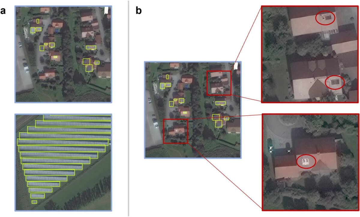
The dataset contains 2,542 PV systems located in southern Germany. The researchers explained that they chose this region due to the high concentration of both residential and commercial PV systems. After acquiring imagery of the area, they randomly chose three areas within the selected region and used software to identify the PV arrays.
They annotated individual solar panel objects manually and, in order to verify their identification, they compared the findings to images from Google Earth, which offers higher resolution images. Objects with potentially only one or two solar modules, either adjoined or separated, were considered as non-panel objects such as skylights, ventilation caps, and chimneys.
“In total, 2,487 solar panel objects, or 97.8%, were identified with high confidence,” the academics stated. “Less than 3.0% of the solar panel objects were identified with moderate or low confidence.”
Popular content
The scientists said the novel dataset can be either used to develop detection models uniquely applicable to satellite imagery or in conjunction with existing solar panel aerial imagery datasets to support generalized detection models.
The dataset was introduced in the study “A solar panel dataset of very high-resolution satellite imagery to support the Sustainable Development Goals,” published in scientific data.
Maxar Technologies made both the image chips and the object labels available online.
This content is protected by copyright and may not be reused. If you want to cooperate with us and would like to reuse some of our content, please contact: editors@pv-magazine.com.


